01 · COLLECT
Synchronized field capture
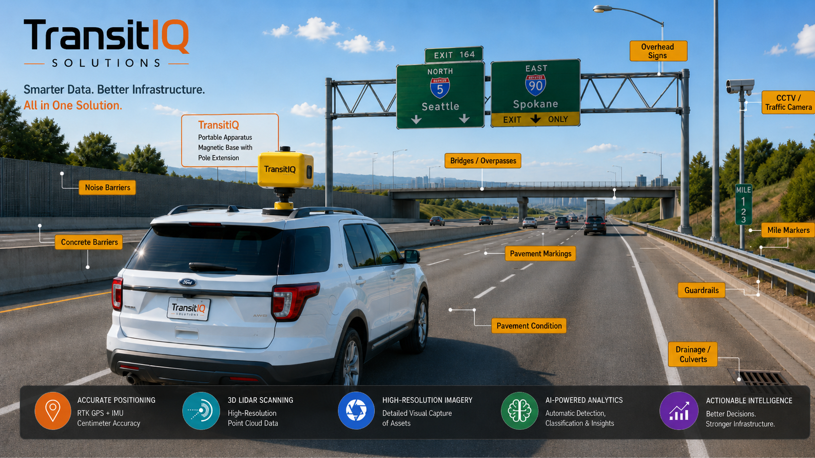
Portable vehicle-mounted sensing combines high-resolution imagery, LiDAR, RTK GNSS, IMU, and related metadata while traveling in normal traffic flow.
TransitIQ Solutions combines portable multi-sensor field collection, AI-assisted asset intelligence, geospatial processing, and agency-ready decision support in one connected workflow.
TransitIQ Solutions helps government agencies, transportation owners, and the consultants and contractors who serve them collect infrastructure information more efficiently, convert it into reliable geospatial asset intelligence, and make faster, better-informed maintenance, safety, planning, and investment decisions.
TransitIQ closes the gap between field conditions and usable asset-management decisions.
Portable vehicle-mounted sensing combines high-resolution imagery, LiDAR, RTK GNSS, IMU, and related metadata while traveling in normal traffic flow.
Computer vision and automated processing detect, classify, read, measure, and evaluate observable asset and condition information with confidence-aware outputs.
Sensor data is fused into location-anchored records with evidence imagery and structured attributes for GIS and asset-management workflows.
Dashboards, maps, exports, reports, prioritized action lists, and trend-ready records support real maintenance and capital decisions.
TransitIQ replaces fragmented inspection steps with one portable, repeatable collection-to-decision workflow.
A self-contained apparatus designed for practical installation on ordinary fleet vehicles rather than dependence on a dedicated mapping vehicle.
RTK GNSS, LiDAR, imagery, and IMU data work together to improve asset-level spatial context and evidence.
Confidence and uncertainty can be surfaced so low-confidence detections can be reviewed instead of hidden behind automation claims.
GIS-compatible records, imagery, dashboards, condition information, and reporting designed around existing operational workflows.
Focused first on asset inventories where agencies need current, georeferenced records without excessive field labor or specialty equipment.
Signs, barriers, markings, pavement, roadside features, safety assets, and corridor inventories.
Catch basins, culverts, drainage features, condition observations, and GIS inventory updates.
Cabinets, cameras, poles, devices, communications-related roadside assets, and field evidence.
Corridor, right-of-way, station, crossing, and infrastructure asset intelligence.
Pavement, markings, perimeter, lighting, and facility asset inspection workflows.
Terminal, pavement, waterside, facility, and multimodal infrastructure inventories.
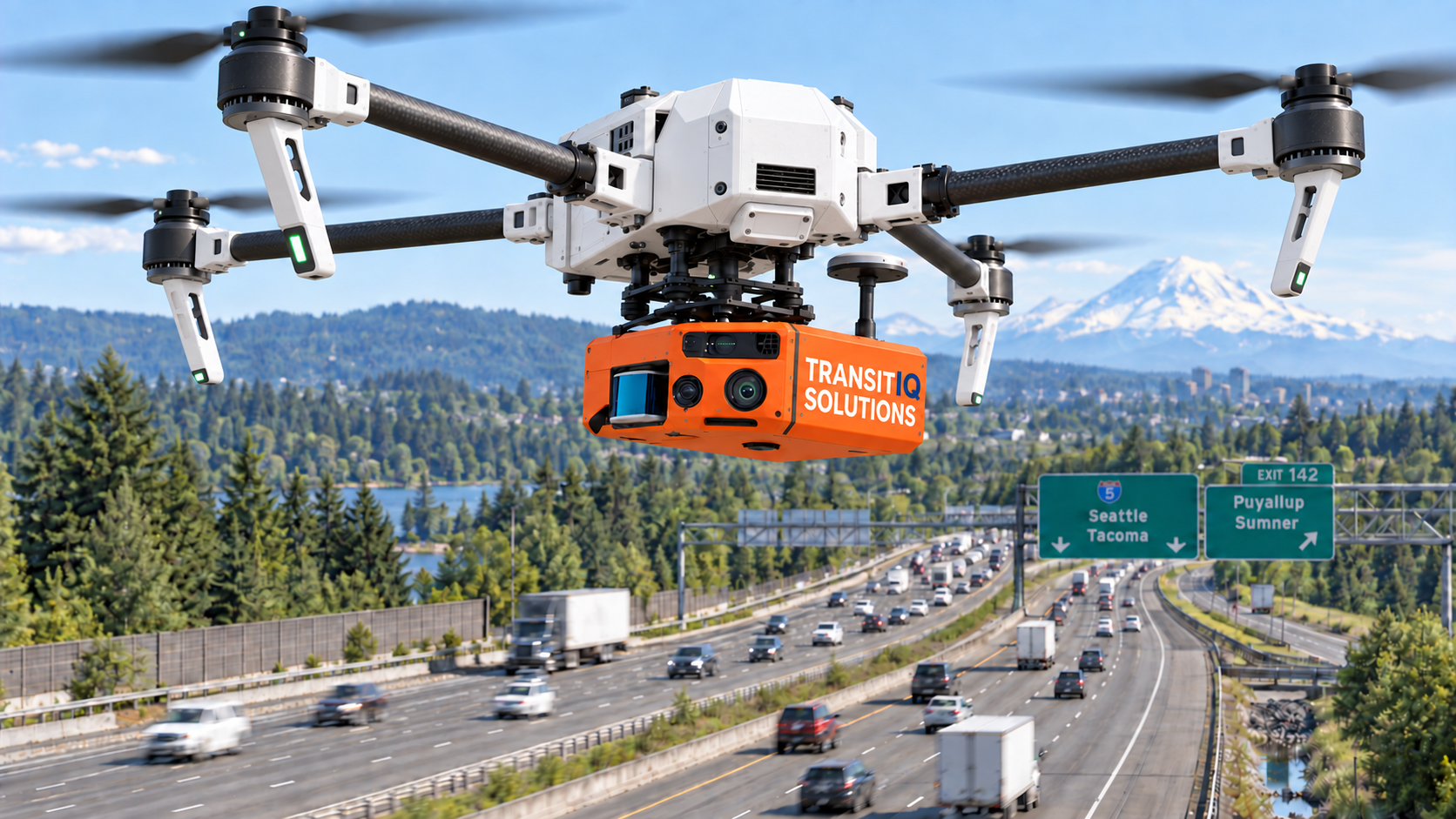
TransitIQ is being developed around a compact, portable sensing approach for ordinary fleet vehicles, specialized mobile platforms, robots, and selected aerial applications. Each deployment will be matched to the asset type, required accuracy, operating environment, and applicable safety requirements.
TransitIQ is grounded in decades of transportation operations, asset management, sensing, engineering, AI/software, GIS/data systems, cybersecurity, prototyping, and commercialization experience.
Founder and engineering lead Tareq Alzeer brings 31 years of Washington State DOT experience spanning highway maintenance and operations, stormwater and drainage, roadside inventory, traffic/ITS, and infrastructure programs.
Define the collection scope, required attributes, accuracy needs, GIS format, and operational outcome. TransitIQ can shape a focused pilot around the information your agency actually needs.